


Voting District 539, Oklahoma County, Oklahoma
About
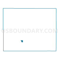
Outline

Summary
| Unique Area Identifier | 654576 |
| Name | Voting District 539 |
| County | Oklahoma County |
| State | Oklahoma |
| Area (square miles) | 0.77 |
| Land Area (square miles) | 0.77 |
| Water Area (square miles) | 0.00 |
| % of Land Area | 100.00 |
| % of Water Area | 0.00 |
| Latitude of the Internal Point | 35.45765230 |
| Longtitude of the Internal Point | -97.48401050 |
Maps


Graphs
Select a template below for downloading or customizing gragh for Voting District 539, Oklahoma County, Oklahoma


Neighbors
Neighoring Voting District (by Name) Neighboring Voting District on the Map
- Voting District 526, Oklahoma County, OK
- Voting District 529, Oklahoma County, OK
- Voting District 531, Oklahoma County, OK
- Voting District 536, Oklahoma County, OK
- Voting District 537, Oklahoma County, OK
- Voting District 538, Oklahoma County, OK
- Voting District 542, Oklahoma County, OK
- Voting District 543, Oklahoma County, OK
Top 10 Neighboring County Subdivision (by Population) Neighboring County Subdivision on the Map
Top 10 Neighboring Place (by Population) Neighboring Place on the Map
Top 10 Neighboring Unified School District (by Population) Neighboring Unified School District on the Map
Top 10 Neighboring State Legislative District Lower Chamber (by Population) Neighboring State Legislative District Lower Chamber on the Map
Top 10 Neighboring State Legislative District Upper Chamber (by Population) Neighboring State Legislative District Upper Chamber on the Map
- State Senate District 43, OK (78,345)
- State Senate District 48, OK (73,775)
- State Senate District 46, OK (71,941)
Top 10 Neighboring 111th Congressional District (by Population) Neighboring 111th Congressional District on the Map
Top 10 Neighboring Census Tract (by Population) Neighboring Census Tract on the Map
- Census Tract 1053, Oklahoma County, OK (3,109)
- Census Tract 1073.05, Oklahoma County, OK (1,360)
- Census Tract 1029, Oklahoma County, OK (607)